California Whitewater Rafting Trips

Raft California
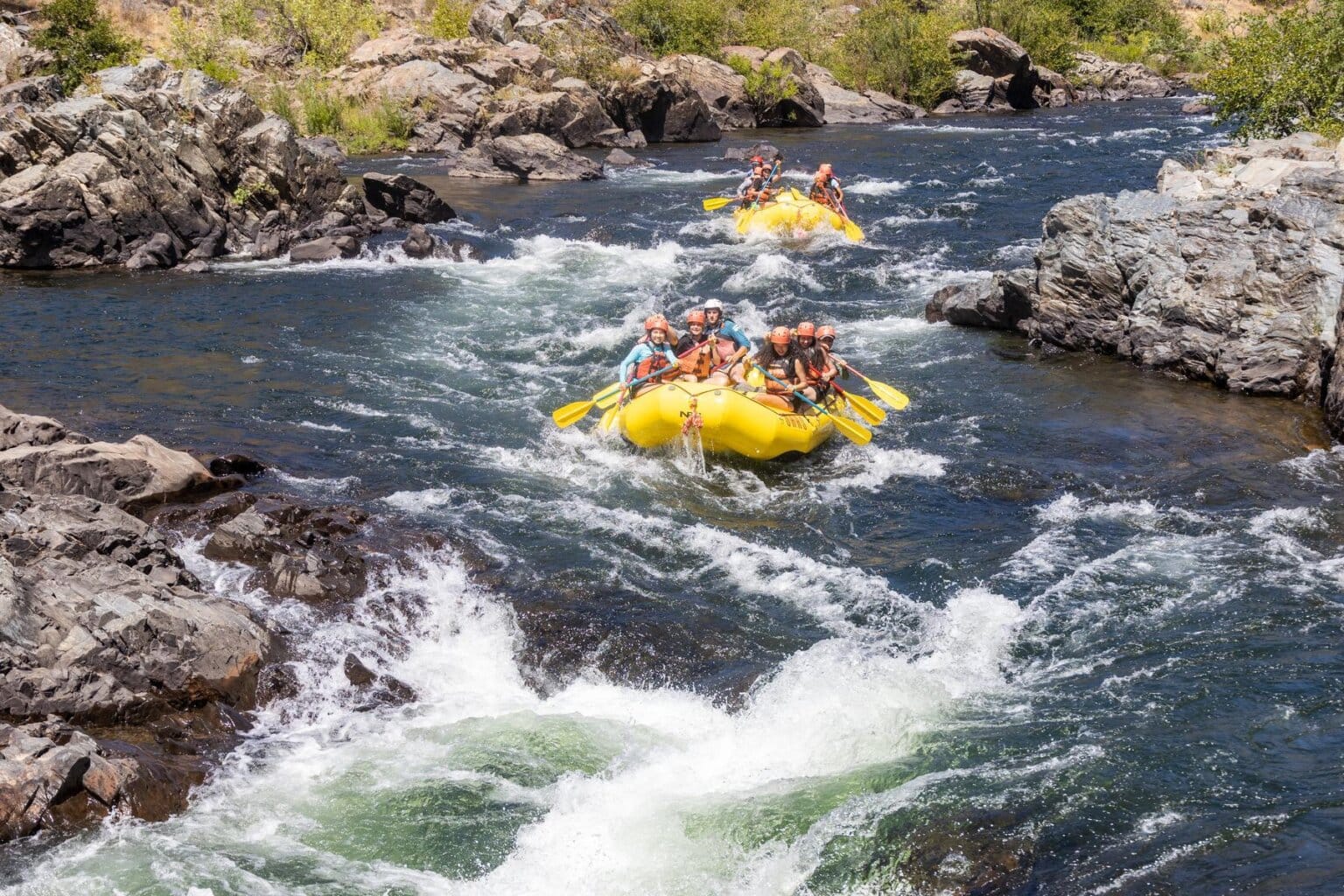
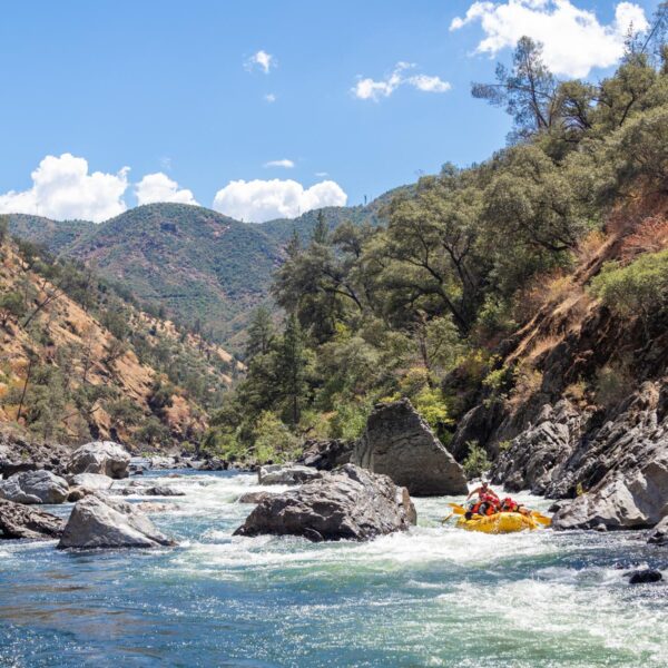
OARS has been providing first-class California whitewater rafting and adventure travel vacations for more than 55 years. We provide rafting trips on several Northern California rivers, including the American River, Tuolumne River, Klamath River, and Merced River, when conditions allow. Whether you are a beginner or an expert, we have a California rafting trip to suit your level of adventure. Our top-notch crew of professional and enthusiastic California river rafting guides will carefully guide you down these scenic rivers for the experience of a lifetime.
But don’t just take our word for it. Find out what hundreds of our guests have said about rafting with OARS in California.

Find Your Perfect Trip
Adventures in California

Tuolumne Whitewater Rafting 1-Day Trip
Location:
California
Adventure Level:
Moderately Challenging
Minimum Age:
14 (16 during high water)
Tuolumne River Rafting Near Yosemite National Park
Location:
California
Adventure Level:
Moderately Challenging
Minimum Age:
14 (16 during high water)

Chili Bar Rafting on the South Fork American 1/2-Day
Location:
California
Adventure Level:
Easier to Moderate
Minimum Age:
8 (10-12 during high water)
South Fork American River Rafting Gorge 1-Day
Location:
California
Adventure Level:
Easier to Moderate
Minimum Age:
8 (10-12 during high water)

South Fork Whitewater Rafting 21-Miler 1-Day
Location:
California
Adventure Level:
Moderately Challenging
Minimum Age:
12

South Fork American River Team Building Express
Location:
California
Adventure Level:
Easier to Moderate
Minimum Age:
8 (10-12 during high water)

Middle Fork American River Rafting
Location:
California
Adventure Level:
Moderately Challenging
Minimum Age:
12

Two-Day South Fork American River Rafting
Location:
California
Adventure Level:
Easier to Moderate
Minimum Age:
8 (10-12 during high water)

Merced River Rafting Near Yosemite National Park
Location:
California
Adventure Level:
Moderately Challenging
Minimum Age:
12 – 14 (9 at low water)

Lower Klamath River Rafting
Location:
California
Adventure Level:
Easier
Minimum Age:
4

California Whitewater Guide School
Location:
California
Adventure Level:
Challenging
Minimum Age:
18

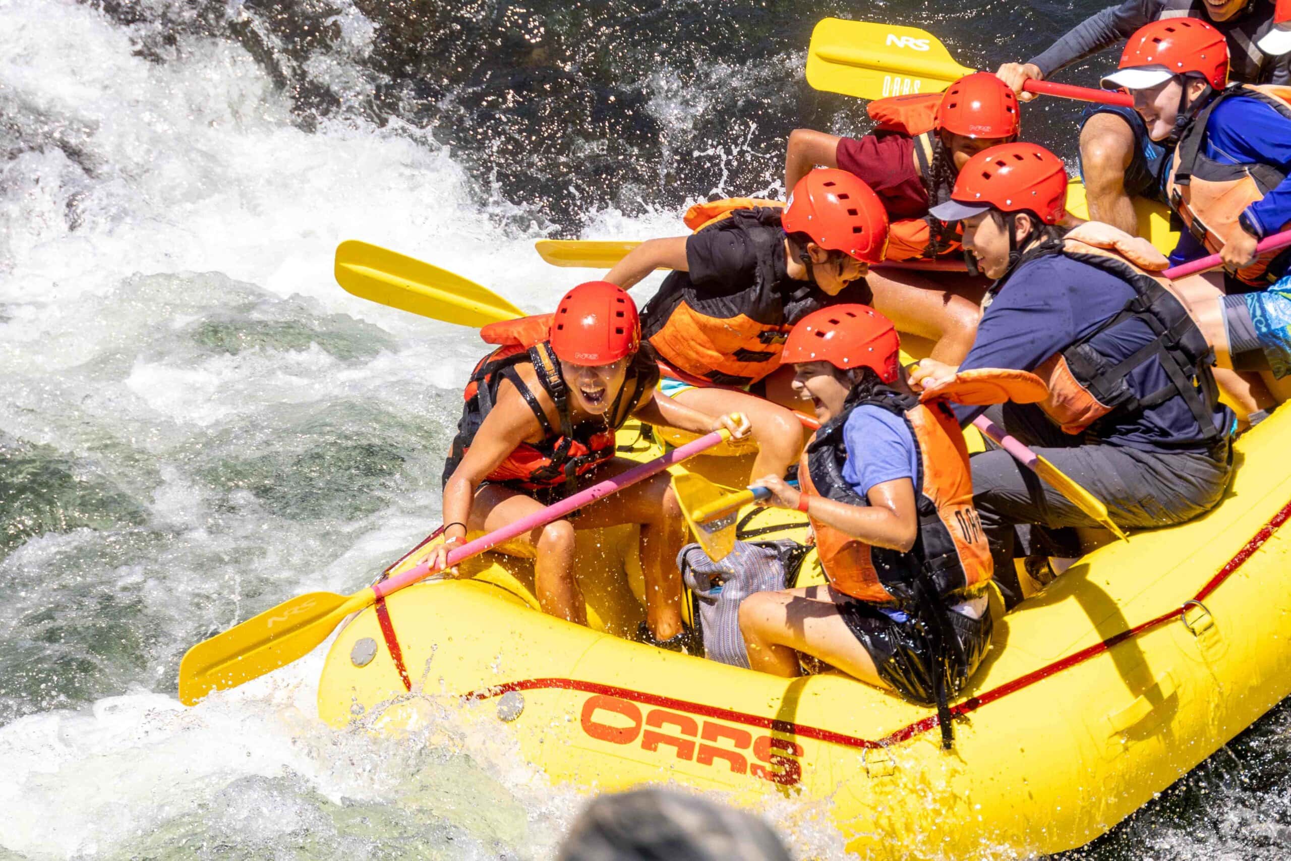
I've done a couple trips with OARS now: two on the South Fork of the American River and a 2 day trip on the Tuolumne. OARS does not disappoint! From incredibly attentive and knowledgeable guides to luxurious camping accommodations, they take care of you. The American River trips are an easy day trip from Sacramento or the Bay Area. If you're looking for a little more adventure, a multi-day guided whitewater trip is so fun, with lots of downtime to swim, look at the stars, play games, and eat yummy food. There's no freeze dried camp meals here. Everything is boated in and prepped on the beach for you. So good. All around, so good.
Paulina D. OARS California guest
California Rafting – Map
What rivers does OARS raft in California?
Join OARS for a classic California whitewater rafting adventure on the American River near Sacramento and Lake Tahoe, the Merced or Tuolumne River near Yosemite or consider a family vacation on Northern California’s Lower Klamath River. The majority of OARS California whitewater rafting adventures are within a half-day’s journey from San Jose and the San Francisco Bay Area, Lake Tahoe, Napa Valley, and Yosemite National Park.
For trips on the American River, OARS operates out of the American River Outpost in Lotus, CA, which has camping, group rafting trip options, and meal plans, as well as a small retail store.
How long are California rafting trips?
OARS California rafting trips run between half-day and three days, depending on the river. Day trip options are available on the South Fork of the American River, the Tuolumne River, and the Merced River. One-day trips on the Middle Fork of the American River are available through an affiliate outfitter. While multi-day rafting trips are available on the South Fork, Tuolumne River and Klamath River.
When is the California rafting season?
The California whitewater rafting season typically runs from April through early October.
Spring (April – May): Peak Runoff
As the winter snowpack melts, California’s rivers roar to life. This is the window to raft free-flowing rivers that lack upstream dams, and the best time for adrenaline-seekers to experience big water and Class IV+ thrills while the rivers are at peak flows.
- What to expect: Faster water, larger waves, and a vibrant landscape. The canyons are at their most beautiful in spring, featuring lush green hillsides and carpets of wildflowers.
Summer (June – August): High Season
Summer is the peak season for rafting in California, offering families, first-timers, and groups a variety of ways to escape the heat. As the season progresses, trips on many free-flowing rivers reliant on snowmelt start to wind down, making the state’s dam-controlled rivers the stars of the summer.
- What to expect: The air is hot, the water is refreshing, and river flows are consistent and predictable, especially on rivers like the South Fork of the American and the Tuolumne, which benefit from scheduled upstream reservoir releases throughout the summer.
Late Summer/Fall (September – October): The Quiet Season
As the peak summer crowds thin out after Labor Day, California rivers enter a serene, golden phase. While dam-controlled releases typically allow for weekend rafting through October on the South Fork and Middle Fork of the American, many outfitters—including OARS—wrap up operations at the end of September. For those in the know, however, the final weeks of the season offer some of the most peaceful conditions of the year.
What to expect: Comfortable temperatures, fewer people on the water, and laid-back weekends with guaranteed flows.
What is the most popular rafting trip in California?
Thousands of people raft the South Fork of the American River every summer, making it one of the most popular trips in the U.S. The 21-mile section provides several rafting options and an ideal balance of adrenaline and fun for families with kids as young as eight. OARS offers half-day trips with lunch, full-day trips with lunch, and wildly fun two-day American River rafting and camping adventures on the South Fork of the American with dinner and breakfast included.
What California rafting trip is right for me?
If you’re looking to progress from a first-time paddler to a whitewater enthusiast, OARS California rafting trips offer a perfect stepping-stone approach.
- For a gentle introduction or a family-friendly vacation with younger children, the 3-day Lower Klamath River trip offers scenic Class II riffles and warm water, perfect for swimming and inflatable kayaking.
- Those ready for consistent Class III action should head to the South Fork of the American River. Whether you choose a half-day Chili Bar trip or a full-day trip through the Gorge, it’s the ideal balance of approachable adventure and splashy fun.
- For experienced rafters and adventurous first-timers, the Tuolumne River near Yosemite is the premier choice. This iconic Class IV+ stretch offers technical rapids, remote wilderness, and a significant jump in intensity for those ready to test their skills.
Where can I learn more about the American River rafting and camping options?
OARS has a digital American River Rafting catalog that has everything you need to know about California’s most popular rafting destination. The full catalog can be found here.


Discover your next OARS Rafting Adventure
